Friday, November 11, 2011

At Least DC'S Got Key


Of all the schools-both public and private in the entire U.S. of A. chosen to receive Blue Ribbon status this year only one was chosen within the confines of the District of Columbia-Francis Scott Key Elementary. It's both an honor and a disgrace that one public school here in the district has achieved so much in a city wide system that has achieved so little. On one hand, we have a great little school like Key where over half of the students are advanced in math- according to test scores. In fact, when the Obamas were school shopping, Michelle Rhee told us that her office crunched the numbers, and Key came up on top.  On the other hand, our system still supports social promotion and retention, meaning, for example, you might be held back a year or two, but eventually- you will still be moved up to high school-reading or not.
I am really proud of Key school's award. It was well earned by teachers, students, parents and staff alike- all working together, but during the furor of the Obama's school search, I heard more than one voice question why the Obama family should "sacrifice" their children to the cause of DC public schools. The Blue Ribbon award program is part of the No Child Left Behind act, and I can't help but roll my eyes at the irony. Maybe one day-though maybe not in my lifetime- DC will be the Blue Ribbon town it could and should be.

Frustrating bird photography

Ever since we named our place "Kingfisher Farm" after one of the first birds we saw here, I've been trying to get a picture of its namesake.

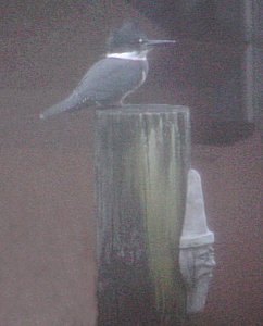
They are wary birds. I haven't been able to get near. So a few days ago when one was perched nearby I grabbed the camera. The only shot I had was through a screened window.


Then he ended up looking like some sort of demon bird anyway.

He swooped down to grab some spilled dog food off the workshop porch! Can't say that I've ever seen Kingfishers do that before. Then, frustratingly, he never came back within camera range.

This morning just as my husband was about to leave for work, we noticed something skulking near the pond. From the size and color I thought it might be a Little Blue Heron, but something wasn't right.

I grabbed the binoculars, and wow! A juvenile White Ibis! Talk about your cool yard birds. Quick, the camera!


Ugh. Much too far away. Oh wait, maybe we should try digiscoping! But hubby had to leave or he was going to be late. When he took off the Ibis did too.

I set up the scope anyway, and hoped he'd come back.

He did!


Ta-da! Not perfect, but a lot better than the camera alone. I had to take about 45 shots to get one that was half-way decent. (There is no way to attach this camera to the scope lens.)

A green heron showed up so I tried photographing him too, but he didn't stay put very long.


Still needs work.

---

White Ibis (Eudocimus albus)
Green Heron (Butorides virescens)
Belted Kingfisher (Ceryle alcyon)

Much better picures than mine:
Juvenile White Ibis
Adult White Ibis
Ibis overhead (wow)

Link to site with other great bird pics and digiscoping articles.

---

Edited to add: Make sure to read the comments for an interesting discussion on the physics of black vs. white feathers!

Thursday, November 10, 2011

The snow is flying

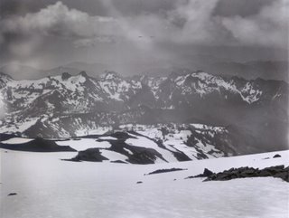
The temperatures plummeted today, and along came precipitation in the form of quite a bit of snow! Camp Muir saw a 29 degree drop in the temperature during the night. Paradise didn't drop that far, but there is some fresh stuff on the ground as the temp hovers near 31... which should help w/ that Muir Snowfield dilemma. A reader contributed this July 29 image taken in 1896! Check out the amount of snow.

It seems that the Camp Muir telemetry has been spotty. It's up and running now, but is occasionally down. I've been told they're going to fix the problem.

Tuesday, November 8, 2011

Pangbuk Ri

Lead climbing ranger David Gottlieb and friend/former climbing ranger/Pacific Northwest hard-man Chad Kellogg put up a harrowing, spectacular, and unprecedented ascent of Pangbuk Ri in Nepal (pictured to the right). Starting their climb early on 10/10/11, they summitted and returned to basecamp in an epic 50 hour push.
Read the full trip-report on Chad's blog here, and see some awesome photos and short video from David's blog here.


With decent weather over the long weekend, lots of backcountry snow enthusiasts were out playing. The NWAA (Northwest Weather and Avalanche Center) started posting updates, check them out here.
Have a safe and inspirational holiday season!

Monday, November 7, 2011

Busy Busy

Like the previous post stated, it's fully summer. Still. The sun has been out consistently during normal daylight hours and the stars have been seen most of the other time. The cloudy marine layer that covered the Puget Sound area most mornings never even made it close to the park boundary. Summertime and the living is easy!


Saturday Morning, Camp Schurman

The scene up here on Rainier the past couple of weeks has been really busy with climbers making many successful ascents of many routes. The Emmons and the DC are still both in great shape. The Emmons is currently the more direct route of the two, offering stellar glacier climbing from Schurman to the summit. Many people have also been climbing the Kautz, encountering moderate and fun conditions in the ice chutes and moderate glacier travel above. We've even gotten a few reports in from climbers who have made recent ascents of the Tahoma, Sunset Ridge, Ptarmigan Ridge and Mowich Face. The approaches on these more remote west side routes are a bit long and involve more encounters with scree and talus this time of year, but the climbing conditions above 9,000' remain great.


Sunset Ridge, photo by Paul Cook

The past couple of weeks we have seen what appears to be an increase in the number of climbing parties having mishaps and/or full on accidents. We as the climbing rangers just want to remind everyone to stay vigilant, know and respect their abilities, stay aware of current conditions, and be ready and prepared to deal with whatever emergency may arise on your own. Help is definitely out there for people if it is needed, but that help might be a long way off which means self rescue is always required to some level.


Stay Safe. Climb Hard.

Sunday, November 6, 2011

Pike Run Dry Tooling


The small outcrops at Pike Run work great for dry tooling
East coast ice climbing has had another dismal week. Above average temperatures and rain are preventing the ice climbing season from getting underway. Locally we've had 40 degree rainy days with evening temps hovering around freezing. Yesterday Laura and I had some time to get out climbing and didn't want the lack of ice this season ruin our motivation. With possible rain in the forecast, we decided to hit a small local spot for some dry tooling. We decided to head over to Pike Run for some dry tool investigation. Pike Run is predominantly a bouldering area with a few 25' outcrops that offer a little top roped climbing. I installed a few bolt anchors on top of the outcrops in 2000 to help lessen the impact of anchoring off the small trees at the top. For those that don't know, I used to own a climbing shop and guide service located about 5 minutes down the road in Donegal. Pike Run offered folks a place to climb very close to my shop. Much to my surprise Pike Run is still being used on a regular basis.


Tim checking out the Citronella Cave V4 to V6


Laura getting ready to give it a go...


Laura on our 3rd climb


Enjoying the new opportunities
The approach trail has had some impressive work done to it. Someone also went as far as to build landings at the bottom of the Tower outcrop at the descent trail. My hat is off to those ambitious folks that took the effort to help maintain this local climbing resource. The rock at Pike Run is sandstone. Its coarse, not nearly as compact and solid as the sandstone located in most places on Chestnut Ridge. The outcrops at Pike Run offer some great dry tool options. Laura and I had a great time exploring and trying out some lines. We climbed 3 lines overall taking laps on each several times. The moves varied from easier M3/4 to M8 with the climbing being somewhat technical and not as straight forward as it looks from the ground. Rounded and sloping are the norm with a few usable cracks here and there. It was nice to revisit and take a serious thrashing at an area I haven't climbed in a few years. I'm sure we'll be back to pump ourselves silly soon enough.


Laura practicing climbing in ice boots without tools


On a non climbing note:

On the way home from Pike Run we were pleasantly surprised to see a pair of Northern Goshawks near Acme Dam on county line road. One was actively hunting and perching while the other perched the whole time far off on a field edged by forest. It will be interesting to see if they are herewintering or passing through to other territory. Goshawks are our largest accipiter and are irregular visitors to our region. They live in the colder, northern climates of Canada during summer and migrate south for the winter. The Goshawk is related to our summer resident Sharp-Shinned and Coopers hawks. Here's a photo we shot of one perched on a dead snag.


Northern Goshawk Accipiter gentilis

near Acme Dam, Dec. 16,

Thursday, November 3, 2011

Mount St Helens :: 30 Years Later

At 8:32 am on May 18th, 1980 a magnitude 5.1 earthquake “shook the ground beneath Mount St. Helens in Washington state, setting off one of the largest landslides in recorded history - the entire north slope of the volcano slid away. As the land moved, it exposed the superheated core of the volcano setting off gigantic explosions and eruptions of steam, ash and rock debris. The blast was heard hundreds of miles away, the pressure wave flattened entire forests, the heat melted glaciers and set off destructive mudflows, and 57 people lost their lives. The erupting ash column shot up 80,000 feet into the atmosphere for over 10 hours, depositing ash across Eastern Washington and 10 other states.” - - from The Big Picture which has a fantastic collection of photos of the volcano and its 1980 eruption.

The western side of Mount Saint Helens as seen from the Visitor Center at Silver Lake, 46 road-miles away.

From a viewpoint on the north-northwest side.
Clouds covered the upper half of the volcano for the entire afternoon with an occasional break, which briefly revealed the peaks. This, and the remaining photos were taken from the Johnston Ridge Observatory. Named for David A. Johnston, a volcanologist on duty nearby on that fateful day. His last words were “Vancouver, this is it!”

The lateral blast exploded to the north toward what is now Johnston Ridge and, quite literally, destroyed everything in its path.

The mountains and valleys were tall old-growth forest. Now all that remains are a few denuded logs lying about like pick-up-sticks.

A park service sign nearby tells a tale of the blast as “spoken” by this stump: “Step up and look at me carefully. Notice my shattered trunk, my missing top. I once stood 150 feet tall, surrounded by a beautiful forest of green and growing trees. When the blast exploded sideways out of the mountain, it plowed through the debris avalanche and swept across the landscape, picking up and carrying large chunks of rock, ice, and splintered wood.”

“Within a minute, I was struck and scoured by the stone-filled wind. My bark and branches were stripped and scattered toward the edge of the blast zone, 17 miles away. As trees that had stood for hundreds of years crashed around me, my upper trunk strained, then shattered in the nearly 700 mph winds. Only a small part of me remains as evidence of the blast's power.”

Down in the valley, the blast dumped 680 feet of debris, filling Spirit Lake to the east with logs and ash.

Johnston Ridge was completely denuded. Spirit Lake lies beneath the far ridge at left-center and St. Helens rises up from the valley on the right.

The early evening light emphasizes the ridges and the gulleys now being carved out by the flow of water.

Another view of cloud shrouded St. Helens from Johnston Ridge in the early evening. All photos were taken on Sunday, September 12th.

The Johnston Ridge Observatory, which is 5 ½ miles from the crater, has some really nice exhibits as well as a 16-minute movie about St. Helens. If you've never been there, it is well worth the 60-mile drive off of Interstate 5 on State Road 504.

A couple of the many websites about Mount St. Helens:
  • The many faces of Mt. St. Helens
  • Mount St. Helens Visitor Guide
  • Mount St. Helens National Volcanic Monument